Hadrian's Wall Path
Although it has been a month since I did the Coast to Coast I am still recovering from the exerts. Superficially, my feet are more or less back to normal, except I'm still shedding dead skin! Deep down though I know that I'm still recovering; my resting HR is about 10-15 bpm higher than normal and just jogging on the treadmill has been much harder than it should be. I haven't even been able to think about some harder sessions at the moment.
As competitive racing appears to be as far away as its ever been, there has been the itch to undertake another long distance path whilst the weather and daylight is still on my side. This time I selected the somewhat shorter Hadrian's Wall Path at 84 miles long, but the nub of this challenge was to complete it within 36 hours. Whilst on paper this is nowhere near as hard as the Coast to Coast both in terms of length and elevation, I didn't want to do anything much harder as my body just isn't ready yet.
Hadrian's Wall Path

Unlike the Coast to Coast I decided to undertake the challenge in aid for charity - Tamworth Wellbeing and Cancer Support. The goal was to raise £84 - i.e. £1 for every mile of the route. They are a small local charity, not just supporting those diagnosed with cancer and other serious illnesses, but also supporting those indirectly affected as well such as friends and family.
I went up on Friday night to a hotel East of Newcastle city centre, just 3 miles from the start at Wallsend. A 4am wake up beckoned and I was at the starting point about 4.40am which gave just enough time for some breakfast and for the tracker to pick up a GPS signal, ready for the off at 5am sharp. At this time of year it was still pitch black, but I was hopeful that a small LED headtorch alongside plenty of street lighting in the early sections would see me through.
Ready for the off just before 5am

Early on I could feel that my legs were a bit lethargic, not a good omen but it was largely in keeping with how they have been feeling recently. More worryingly the bottom of my back was really aching as a result of jarring it whilst putting my kit together a couple of days earlier. It wasn't enough to ever consider stopping, but it certainly made it difficult to twist or run on anything other than a flat surface. There were a number of sections early on where it was difficult to tune into the map where the detail was insufficient compared to what I was seeing on the ground. This was exacerbated by the lack of light, where often I was following various paths in parks and the like. In one case I remember following the Hadrian's Wall bike path which I assumed was one and the same at this point of the route, but I quickly learnt it was not the case.
The first few miles eventually connected with the River Tyne which made for pleasant, albeit unexciting running. I passed under the Tyne Bridge at 5 miles in 45 minutes, so if anything was a touch too fast. The route continued alongside the Tyne for another couple of miles, before slightly diverging away on a combination of roads, parkland and estate paths. I wasn't expecting much at this stage of the route, but it was entirely unmemorable. Eventually the route reconnected with the Tyne, which at this stage now resembled more of a normal river once the city had been left behind. I then left the Tyne and headed for Heddon on the Wall and the first scheduled meeting point with my wife at 15 miles in at 7.20am.
I decided upon only having the quickest of breaks before heading off as I felt that stopping for too long could just result in my legs and back stiffening. I also decided to continue in my trainers for the time being - it was a no brainer for the tarmac sections but going forward it was a 50/50 call. As it turns out I stayed in my trainers for the whole trip, the sections in the centre of the route that warranted off road shoes were few and far between. Had the ground conditions been wet, it might have been a different call but I was satisfied with the choice I made.

The following 10 miles were either on rural roads, or on a path running alongside. The tarmac was easier but it came at a cost of more pounding. The terrain was rolling so there was little reason not to run. In the coast to coast, there were frequent sections where it was either too steep or rough to run, so it acted as a sort of respite. In contrast the Hadrian's Wall route had very little of this so it was just a case of grinding out the miles. As the miles ticked by I was feeling more and more tired, certainly more so than the equivalent stage of the Coast to Coast. There was also relatively few distractions, there were certainly plenty of earthworks, but virtually nothing left of the wall itself. I reached the 25 mile point by the A68 at 9.20, so I had more or less completed a marathon in 4.20.
Approaching the second stop at mile 25.

I gobbled some food and other than a few minutes respite I was keen to keep moving. However, just beyond the meeting point I started to feel really rough to the point where I thought I was about to be sick. I had to slow to a walk and hope the feeling passed. I was pretty sure it was just too much sweet food and the jigging in my stomach upsetting me somewhat. Thankfully by slowing to a walk for 20 minutes I felt much better and I was able to slowly start running again. I was certainly not running anywhere near as freely now, more of a shuffle as it was difficult to raise my legs, but I kept plodding along. With just a couple of miles to the 35 mile checkpoint I entered Northumberland National Park and finally the terrain started to improve. Whilst I was still largely following the line of the main road, the terrain was more aligned to that of moorland than the preceding miles which were mostly (pleasant but unremarkable) farmland. I got to the checkpoint at 12.10pm and again other than a few minutes rest, the plan was to have a proper lunch stop at the next checkpoint.
Wave on the way to the 35 mile checkpoint. Conditions slowly starting to transition from farmland into more rough pasture.

Not far now to the 35 mile checkpoint

Despite how I was feeling, I was satisfied with my progress to date. I had been slowing down bit by bit during the day, but this wasn't entirely to be unexpected, but also due to the terrain becoming harder. To finish within 36 hours, I knew I really needed to do a minimum of 50 miles today, so I was certainly on, if not ahead of target. I knew the next 10 miles were going to be more challenging but I was surprised by the reality. The day was now getting extremely warm but the terrain, despite only peaking at <350 metres, involved lots of extremely steep ascents and descents in quick succession. This made the going painfully slow at times and my feet were now getting a good bashing as well. That said, the views were now breath taking and Hadrian's Wall was in very good condition and mightily impressive. Despite how slowly I was now going, the sort of terrain I was now on was what made the challenge worthwhile.
The terrain transitioned into open moors that were very up and down and extremely steep.


A few miles before the next checkpoint my wife managed to find a spot where the route crossed a minor road. It couldn't have come soon enough as I was now pretty much out of drinks as I had underestimated how hard, long and hot this section was. Suitably refreshed, the last couple of miles to the checkpoint at Aesica Fort were not quite as hard and I rolled in at 3.10pm. It took 3 hours to do 10 miles - even though I was running as much of this section as possible it just goes to show how hard the terrain was. Another point of note was how busy it was, there were literally hundreds of people out enjoying the day, but it also made the terrain feel a little less remote which was a shame.
I was now 46 miles in and it was now 3.10pm. With a scheduled rest of 20 minutes for some proper food (a tin of Full English Breakfast), I knew I had around 4 hours or so of daylight remaining. It was clear that even if the terrain became easier I wasn't going to be getting as far as Carlisle today at 71 miles in. I was likely to be at or low 60's, but I also didn't see the point of pushing it much further than this when the overall distance is 84 miles. On my first day of the Coast to Coast I managed 62 miles over harder terrain, but finishing at 9.15pm resulted in it compromising the rest of the trip.
Tin of Full English with a visitor!

There was another 11 miles to the next checkpoint at Banks (57 miles), but the reality was that there were a number of opportunities to meet up with my wife along the way. The first 3 miles or so of this leg were still fairly hard on the legs but from that point onwards it started to transition back into rough pasture and farmland. Although extremely tired, I was also starting to get a bit of a second wind and I felt like I could have continued much later into the evening. Every now and then I'd intersect with my wife and top up with drinks as and when required and it was always nice to have a loved one nearby. I arrived into Banks at 6.30pm and I had now definitely decided that come 7.30pm I'd call it a day as the light was already beginning to fade. The only remaining question was where to finish? There were various opportunities, but in the end I decided that Walton village at 60.25 miles would probably be it. I could stop a little later, but these would have just been random roadsides and it just didn't feel right. I ended up finishing at 7.22pm.
Last 90 minutes or so before the day finishing.

We then had a 25 minute drive to a hotel in Carlisle. The hotel was completely unremarkable, but it was clean enough and did the job for £45 considering my wife only booked it a couple of hours before arriving. The secondary advantage of finishing a touch earlier was that we could have some proper food, rather than just prepared shop bought or takeaway junk food. We ended up going to a Toby Carvery and it did just the job!
Overall, a pretty good first day. Less mileage than the first day on the Coast to Coast (60.25 vs 62) on easier terrain, but considering I had still not recovered properly from my efforts a month previous, I couldn't complain. Whilst my legs felt far more tired early on in the day, I was able to keep on going and had there been more daylight (two hours more daylight in C2C) I could have gone much further. In contrast, I was almost crawling my way into Shap on the first day of the C2C. Whilst I was still exceptionally tired, I felt more mentally with it as well.
Day 2
As I had done the hard graft on the first day, it meant that there was only <26 miles or so left to go today. Unless there was a catastrophe, finishing within 36 hours was now a formality. I therefore decided to have a small lie in. Small, as in not having to start in the pitch black at 5am and instead get up at 6am for a 7am start! My legs felt very stiff which was not entirely unsurprising and one knee was very sore as was the ankle on the opposing leg. However, on the whole I felt much better than the start of the second day on the C2C. I reckoned that even if the wheels fell off, I would still be finishing by 3pm, but the aim today was to finish as I had started and to run as much as my body allowed.
I started just after 7am and I pretty much ran solid all the way into Carlisle. I covered the 11 or so miles in 2.15, only stopping for the odd drink when I needed it or to cross stiles etc. I was not going at an earth shattering pace, but it was running and I was knocking off the miles at a decent lick. I had agreed with my wife for her just to leave me to it, so she could go back to the hotel in Carlisle and sort herself out, but as it turned out I covered the terrain so quickly that I had already passed the checkpoint before she had left the hotel. This was no matter as I had already planned for this eventuality as the checkpoint (a car park slightly off route) wasn't in a great location. The reality on the ground proved my suspicions right, not only was the cark park off route, but I couldn't even see it and it wasn't even obvious where it would have been. On top of this my progress was so good, I also didn't want the excuse of stopping for a break when I didn't need it, or find that stopping broke my rhythm.
Not far from Grinsdale. Cracking progress.

Although my next checkpoint was not until Burgh by Sands at 77 miles, I guessed that I was going to see my wife sooner than that. This proved to be true and I saw her waiting as I approached Grinsdale at about 74 miles in. At this point I felt like I needed that break and top up on drinks and snacks. I only now had about 11 miles left of the whole trip and I tried to keep pushing to see whether I could finish before 1pm, perhaps even midday. Only just after, I managed to make my only semi-serious navigation error. Somehow I missed the obvious stile at the opposite side of an oddly shaped curved field and instead followed what must have been an animal track. I got to the end of the field to find a padlocked gate and much confusion. I eventually traced back and eventually saw what I had done. It only cost me 2-3 minutes but still an annoyance - I had been concentrating so much on my running that I failed to look where I was going.
I passed through Burgh by Sands at 77 miles at 10.45am and now it was just 8 miles to go. Such was my frame of mind, that I decided not to stop here at all and to keep pushing on. I just had to follow a pancake flat straight road for the next 3-4 miles and I tried to go as fast as my legs would allow. I was now really pushing to see whether I could finish before midday. However, the legs eventually decided that they had enough and that I had been mentally overriding the pain for so long that eventually I couldn't set aside the fatigue any longer. It was at this point I knew the midday finish was no longer on, but also because although the route is 85 miles my A-Z guide published mile markers and the guidebook had an 86th mile!
About 6 miles to go, pancake flat but starting to flag!

By now the terrain was basically flat and was a sort of salt marsh with a road running through it. I was surprised that despite being so close to the sea, I couldn't actually see it! Eventually it came into view, but I then did a final set of doglegs away from the coast before re-joining it and I agreed with my wife that I would now just see her at the finish line which I reckoned would be a little over 45 minutes away. As much as I wanted to see her, I was now pretty dead on my feet and I just didn't want the excuse to keep stopping.
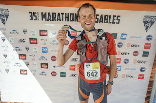
As much as I now just wanted to walk to the finish, I found the strength to run again and I made it my target to do the remaining 3-4 miles without stopping. I kept pushing and it was getting harder, but the closer I got, I pushed even more to the point where I was probably going at my normal training pace. The last couple of miles were almost pleasant as you could see Scotland on the other side of the Solway and the myriad of sandbanks in between. I eventually finished at 12.23pm at the hut which forms the formal start / finish at Bowness on Solway. In total I took 31 hours 23 minutes and 53 seconds, so was well inside my 36 hour target. My moving time (which also includes stops during each day) was about 19 hours 43 minutes.
Finished!


I was absolutely cream crackered but finished in a bit more of a sane state than the C2C. My feet are much better as well, a couple of my toes have a bit more bashing but nothing major and not a single blister this time. I only seem to have come away with a single puffy ankle which will soon subside and a sore knee.
What did I make of it all? I still enjoyed it but I guess nothing is as good as the C2C which was a real adventure with far more highs and lows along the way. As it was also the first long distance route I've done I guess it was always going to be more memorable. Trying to put that aside though, the C2C is a far more scenic trip that crosses three very different National Parks; it therefore becomes difficult to beat. I enjoyed the Hadrian's Wall Path all the same, but there are large sections, particularly the first 25 miles which were here nor there. The best bits are between miles 35-50 which are visually stunning and where the wall is most prominent and the last 5 miles along the Solway.
What made it all the more worthwhile was that at the time of writing is having raised £212 + £49 Gift Aid for the charity and having smashed my initial £84 target. On the off chance anyone reads this and feels the urge to donate you can do so through the link below:
https://www.justgiving.com/fundraising/HadriansWallPath2020


Comments
Post a Comment